Hurricane Season is Awake
Image via National Hurricane Center/NOAA
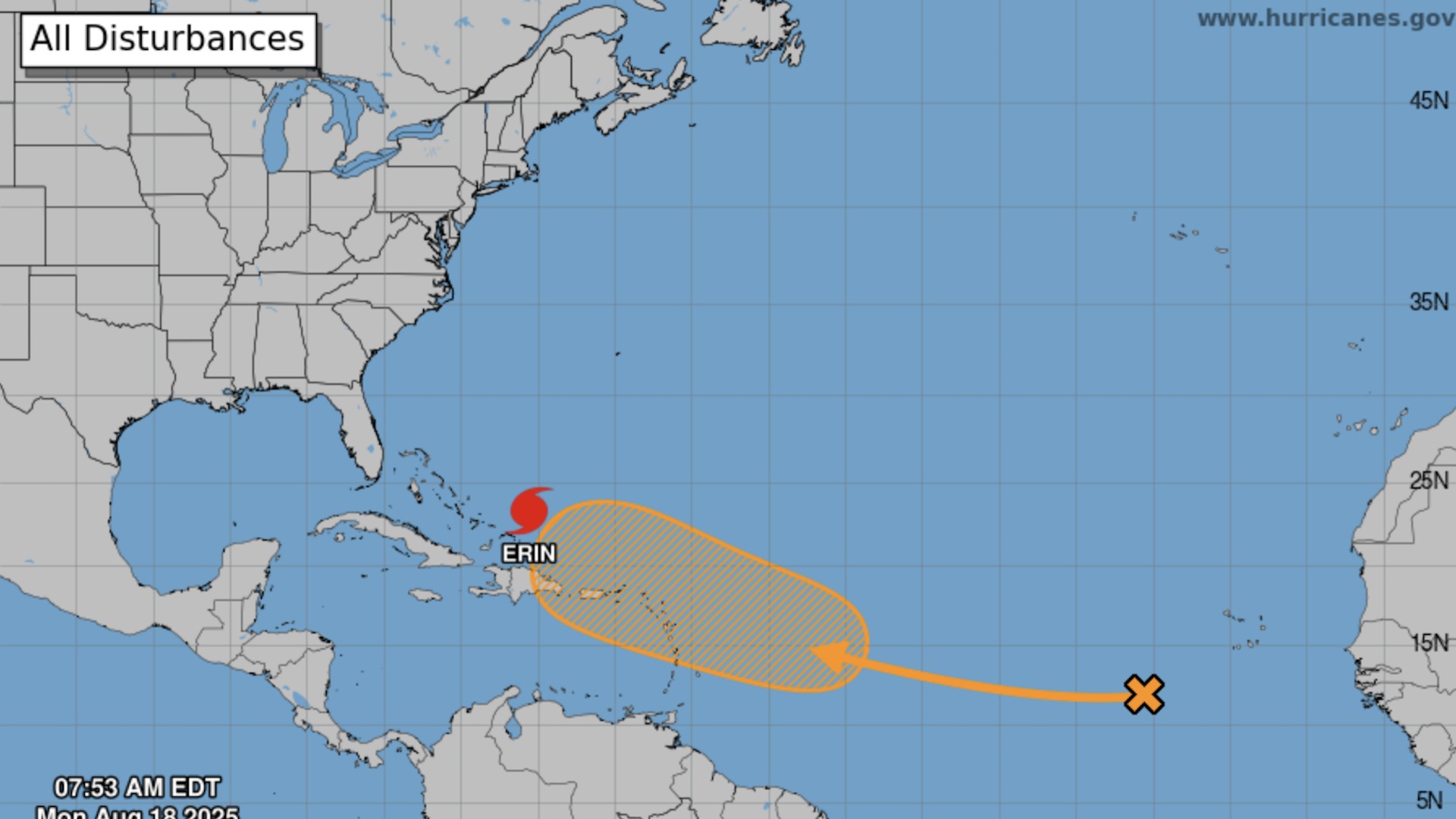
As we noted a week ago, then-tropical storm Erin was worth keeping an eye on. So here is the update: the storm, now a major hurricane, will likely skirt land by a reasonable margin, churning up waves and dropping some rain but probably avoiding major impacts. But as we also noted last week, “if it’s not Erin, it will be the next storm” — and there is another one right in Erin’s wake.
-

-
-
-
-
-
-
-
-
-
-
-
-
-
-
-
-
-
-
-
-
-
-
-
-
-
-
-
-
-
-
-
-
-
-
-
-
-
-
-
-
-
-
-
-
-
-
-
-
-
-
-
-
-
-
-
-
-
-
-
-
-
-
-
-
-
-
-
-
-
-
-
-
-
-
-
-
-
-
-
-
-
-
-
-
-
-
-
-
-
-
-
-
-
-
-
-
-
-
-
-
-
-
-
-
-
-
-